France
Via Podiensis (Le Puy)
The Via Podiensis (GR 65) is the great French route from Le Puy-en-Velay to Saint-Jean-Pied-de-Port, where it meets the Camino Francés. It crosses the volcanic Auvergne, the causses and the rolling Gers — France's most loved and most walked chemin.
- Distance
- 751 km
- Stages
- 31
- From
- Le Puy-en-Velay
- To
- Saint-Jean-Pied-de-Port
Why pilgrims walk it
- 1
The classic French Way from Le Puy to the Pyrenees
- 2
Volcanic uplands, medieval villages and superb gîtes d'étape
- 3
A free guide — offline maps available as an in-app purchase
A look inside the app
Real screens from the dedicated guide.
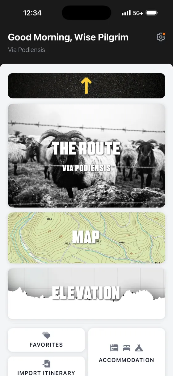

What's inside the Via Podiensis (Le Puy) guide
Every dedicated Wise Pilgrim guide carries the same complete toolkit — built for one route, working offline.
Build your own stages
Every word of the printed Wise Pilgrim guide, laid out as one continuous read instead of fixed daily stages. Walk the distances that suit you — and the itinerary planner shapes the route around the stages you build.
Beautiful topographical maps, online and off
Topographical offline maps for this free guide are an optional $0.99 in-app purchase.
Weather forecast for the trail ahead
A 7-day forecast for the route in front of you, plus the next 2½ days hour by hour — so you know whether to start at dawn or wait out the rain.
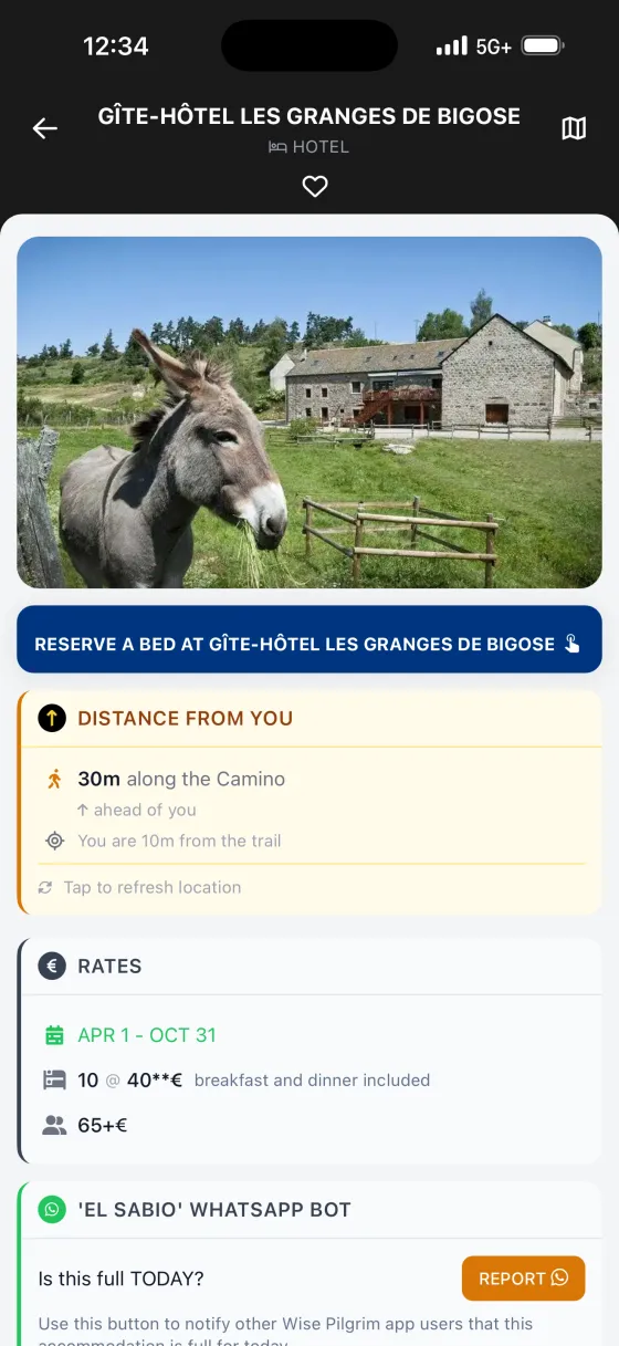
The full accommodation directory + reservation helper
Every albergue, pension, hotel and casa rural on the route — searchable, with the ones you can book online flagged. Tap WhatsApp and the app drafts your first booking message in the local language.
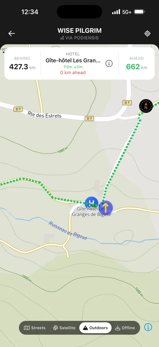
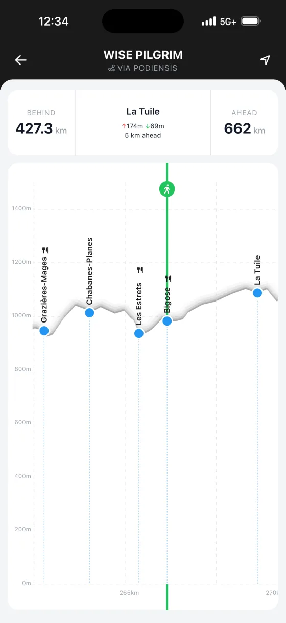
One interactive elevation profile
The whole route's climbs and descents in a single uninterrupted profile. Tap anywhere to read distances, and watch your position move along it in real time.
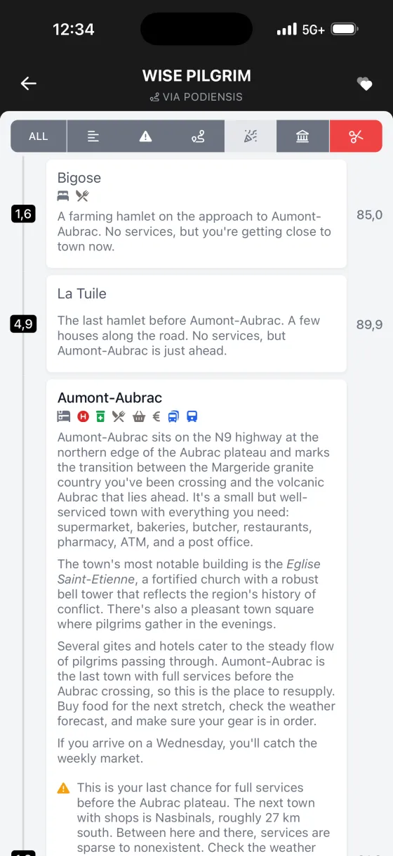
Fountains, pharmacies, ATMs, lookouts and more
The map carries a whole layer of points of interest — water fountains, pharmacies with opening hours, ATMs, picnic areas, archaeological sites, viewpoints — right where they are on the trail.
Yellow X — your geolocation toolkit
The beloved Yellow X is back: see exactly how far you are from the next town or the nearest albergue, the moment you wonder. Your digital reassurance on a long afternoon.
Hundreds of photos, all offline
900+ photos of albergues, landmarks and the path itself, stored on your phone so they load with no signal. Know what you're walking into before you get there.
Notes — and map pins for what you noticed
Leave a note on any town, albergue or stop, or drop a pin for water, a viewpoint, a photo spot. Every note gathers on one searchable, exportable page, and stays private on your phone.
Pronunciation guide to every place
How to say every town and place name on the Camino — so you can ask for it, and recognise it when a local says it back.
Other Caminos to walk
Each has its own dedicated Wise Pilgrim guide.
Take the Via Podiensis (Le Puy) in your pocket
The full guidebook, offline maps and accommodation directory — no signup, no login.