France & Spain
Camino Francés
Il Camino Francés è il cammino che la maggior parte dei pellegrini immagina — la grande traversata dei Pirenei da Saint-Jean-Pied-de-Port, attraverso la meseta e fin dentro la Galizia. È il più percorso, il meglio attrezzato e il più sociale di tutti i Cammini, con albergues ogni pochi chilometri per tutto il tragitto.
- Distanza
- 790 km
- Tappe
- 33
- Da
- Saint-Jean-Pied-de-Port
- A
- Santiago de Compostela
Perché i pellegrini lo camminano
- 1
Il classico primo Cammino di 790 km, con infrastrutture a ogni tappa
- 2
Attraversa la Navarra, La Rioja, la meseta castigliana e la Galizia
- 3
Più affollato in estate — qui l'elenco e i consigli dell'app contano di più
Uno sguardo all'app
Schermate reali della guida dedicata.
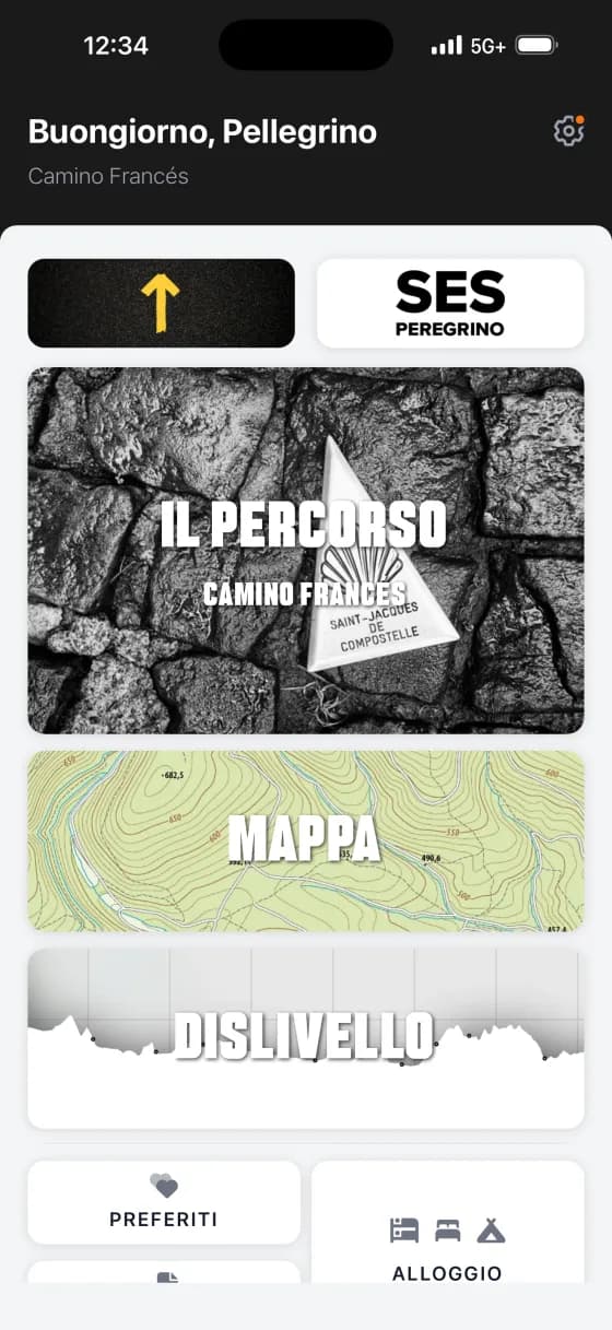
Cosa c'è nella guida del Camino Francés
Ogni guida dedicata Wise Pilgrim contiene lo stesso kit completo di strumenti — pensato per un singolo cammino, funzionante offline.
Costruisci le tue tappe
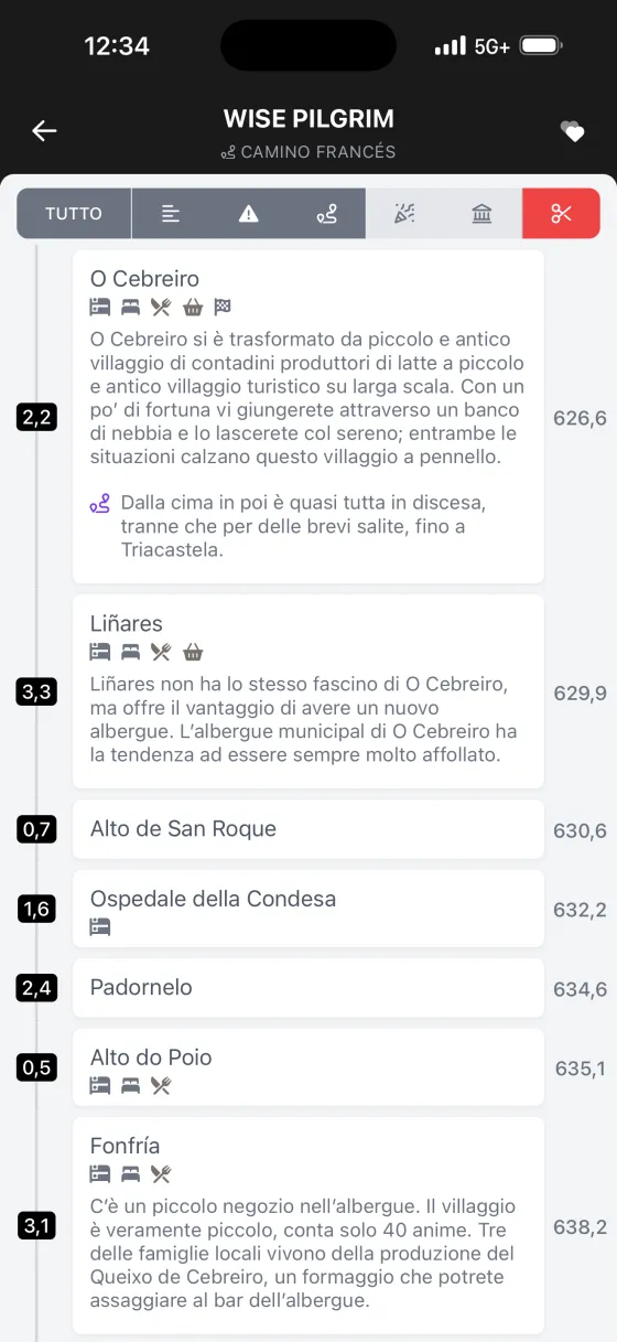
Ogni parola della guida cartacea Wise Pilgrim, presentata come un'unica lettura continua invece che in tappe giornaliere fisse. Cammina le distanze che fanno per te — e il pianificatore di itinerario modella il percorso intorno alle tappe che costruisci.
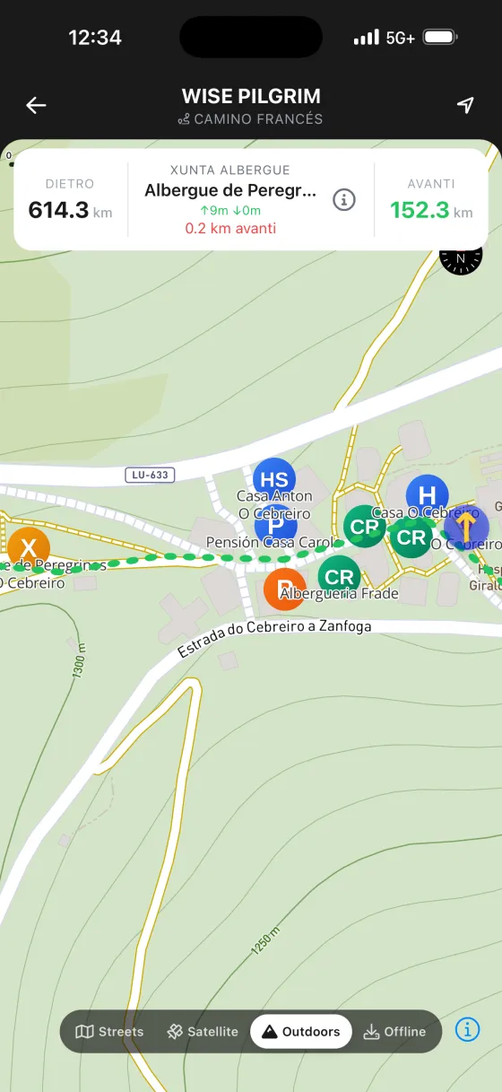
Bellissime mappe topografiche, online e offline
Mappe topografiche con rilievo, rifinite a mano, che scarichi prima di partire e con cui ti orienti senza alcun segnale — in un paesino di pietra, in fondo a una valle o in modalità aereo. Incluse gratuitamente nelle guide a pagamento.
Previsioni meteo per il cammino davanti a te
Previsioni a 7 giorni per il percorso che hai davanti, più i prossimi due giorni e mezzo ora per ora — così sai se partire all'alba o aspettare che passi la pioggia.
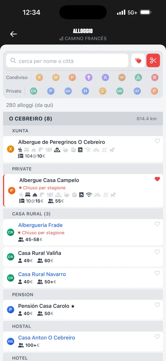
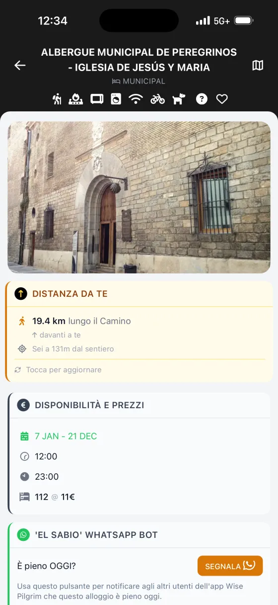
L'elenco completo degli alloggi + assistente alle prenotazioni
Ogni albergue, pensione, hotel e casa rural lungo il percorso — con ricerca, e con quelli prenotabili online segnalati. Tocca WhatsApp e l'app prepara il tuo primo messaggio di prenotazione nella lingua locale.
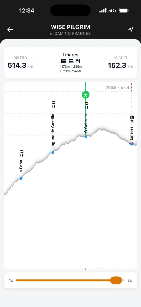
Un profilo altimetrico interattivo
Tutte le salite e le discese del percorso in un unico profilo ininterrotto. Tocca un punto qualsiasi per leggere le distanze, e guarda la tua posizione muoversi lungo di esso in tempo reale.
Fontane, farmacie, bancomat, punti panoramici e altro
La mappa contiene un intero livello di punti d'interesse — fontane d'acqua, farmacie con gli orari di apertura, bancomat, aree pic-nic, siti archeologici, punti panoramici — proprio dove si trovano lungo il cammino.
Yellow X — il tuo strumento di geolocalizzazione
L'amato Yellow X è tornato: vedi esattamente quanto sei lontano dal prossimo paese o dall'albergue più vicino, nel momento in cui te lo chiedi. La tua rassicurazione digitale in un lungo pomeriggio.
Centinaia di foto, tutte offline
Oltre 900 foto di albergues, luoghi notevoli e del cammino stesso, salvate sul telefono così si caricano senza segnale. Sai cosa ti aspetta prima di arrivarci.
Note — e segnaposto sulla mappa per ciò che hai notato
Lascia una nota su qualsiasi paese, albergue o tappa, oppure metti un segnaposto per l'acqua, un punto panoramico, un bel posto per le foto. Ogni nota si raccoglie in un'unica pagina ricercabile ed esportabile, e resta privata sul tuo telefono.
Guida alla pronuncia di ogni luogo
Come pronunciare ogni paese e nome di luogo sul Cammino — così puoi chiederlo, e riconoscerlo quando un local te lo dice.
Altri Cammini da percorrere
Ognuno ha la sua guida dedicata Wise Pilgrim.
Porta il Camino Francés in tasca
La guida completa, le mappe offline e l'elenco degli alloggi — niente registrazione, niente login.