Spain
Vía de la Plata
Die Vía de la Plata ist die lange Straße nordwärts von Sevilla — der längste der Haupt-Caminos, der einer römischen Silberstraße hinauf durch die Extremadura und Kastilien folgt, bevor er Santiago erreicht. Sie ist abgelegen, im Sommer heiß und zutiefst lohnend für Pilger, die Einsamkeit und römische Geschichte suchen.
- Distanz
- 960 km
- Etappen
- 34
- Von
- Sevilla
- Bis
- Santiago de Compostela
Warum Pilger ihn gehen
- 1
Der längste klassische Camino mit rund 960 km
- 2
Römerstraßen, Meilensteine und die Städte Mérida und Salamanca
- 3
Lange, ruhige Etappen — sorgfältige Planung und das Verzeichnis sind unverzichtbar
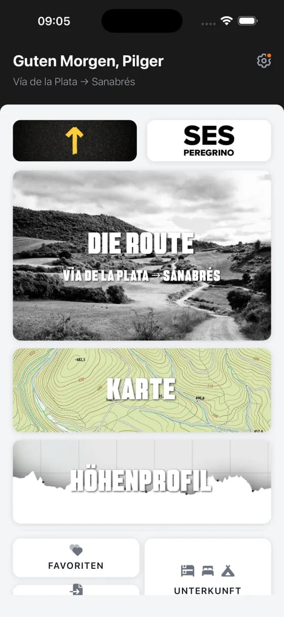
Ein Blick in die App
Echte Screens aus dem Routenführer.

Was im Vía de la Plata Führer steckt
Jeder eigene Wise Pilgrim Führer trägt dasselbe komplette Werkzeug in sich — gebaut für eine Route, offline nutzbar.
Bau dir deine eigenen Etappen
Jedes Wort des gedruckten Wise Pilgrim Führers, angelegt als ein durchgehender Text statt als feste Tagesetappen. Geh die Distanzen, die zu dir passen — und der Etappenplaner formt die Route rund um die Etappen, die du dir baust.
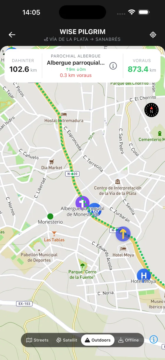
Schöne topografische Karten, online und offline
Von Hand abgestimmte, papierartige topografische Karten, die du vor der Abreise herunterlädst und ganz ohne Empfang nutzt — in einem Steindorf, in einem tiefen Tal oder im Flugmodus. In den kostenpflichtigen Führern gratis enthalten.
Wettervorhersage für den Weg vor dir
Eine 7-Tage-Vorhersage für die Route vor dir, dazu die nächsten 2½ Tage Stunde für Stunde — damit du weißt, ob du im Morgengrauen loslaufen oder den Regen abwarten solltest.
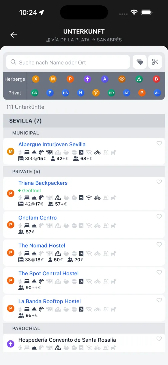
Das komplette Unterkunftsverzeichnis + Reservierungshilfe
Jedes Albergue, jede Pension, jedes Hotel und jede Casa Rural auf der Route — durchsuchbar, mit Markierung der online buchbaren. Tippe auf WhatsApp und die App formuliert deine erste Buchungsnachricht in der Landessprache.
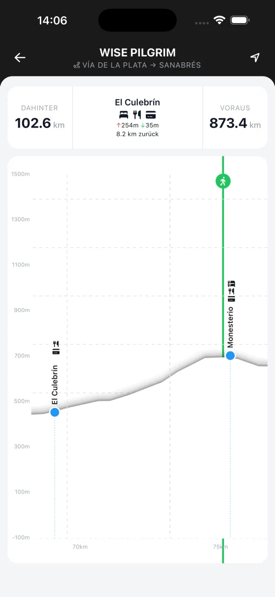
Ein interaktives Höhenprofil
Alle Anstiege und Abstiege des ganzen Weges in einem einzigen durchgehenden Profil. Tippe irgendwohin, um Distanzen abzulesen, und sieh, wie sich deine Position in Echtzeit darauf bewegt.
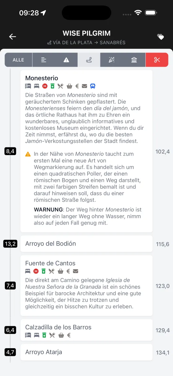
Brunnen, Apotheken, Geldautomaten, Aussichtspunkte und mehr
Die Karte trägt eine ganze Ebene an interessanten Orten — Trinkbrunnen, Apotheken mit Öffnungszeiten, Geldautomaten, Picknickplätze, archäologische Stätten, Aussichtspunkte — genau dort, wo sie am Weg liegen.
Yellow X — dein Geolokalisierungs-Werkzeug
Das beliebte Yellow X ist zurück: Sieh genau, wie weit du vom nächsten Ort oder vom nächsten Albergue entfernt bist, im Moment, in dem du dich fragst. Deine digitale Beruhigung an einem langen Nachmittag.
Hunderte Fotos, alle offline
Über 900 Fotos von Albergues, Sehenswürdigkeiten und dem Weg selbst, gespeichert auf deinem Handy, damit sie ohne Empfang laden. Wisse, was dich erwartet, bevor du ankommst.
Notizen — und Kartenpins für das, was dir auffiel
Hinterlasse eine Notiz zu jedem Ort, Albergue oder Halt, oder setze einen Pin für Wasser, einen Aussichtspunkt, eine Fotostelle. Jede Notiz sammelt sich auf einer durchsuchbaren, exportierbaren Seite und bleibt privat auf deinem Handy.
Aussprachehilfe für jeden Ort
Wie man jeden Stadt- und Ortsnamen auf dem Camino ausspricht — damit du danach fragen und ihn wiedererkennen kannst, wenn ein Einheimischer ihn dir nennt.
Weitere Caminos zum Gehen
Jeder hat seinen eigenen Wise Pilgrim Führer.
Nimm den Vía de la Plata in deine Tasche
Der komplette Reiseführer, Offline-Karten und Unterkunftsverzeichnis — keine Anmeldung, kein Login.